|
|
Geodesy & Geophysics RESEARCH
OVERVIEW |
|
Geodesy, in the history of science, is one of the oldest disciplines. It has a noble tradition
in the development of the classical physical science. Great names like Gauss, Laplace, Bessel,
Newton, and Euler have left their mark on science through their studies of geodesy. Geodesy has
been used to measure outer shape and inner composition of the earth utilizing gravity and
magnetic fields, isostasy, space technology, astronomy, and terrestrial measurements. The shape
of earth is defined by the gravity field, which varies from place to place, thus making it an
irregular surface. For mapping purposes, the shape of the earth is defined by two different
surfaces, such as a horizontal datum, or an ellipsoidal surface, defined by semi-major and minor
axes, and a vertical datum; a geoid or an equipotential surface, which is physically represented
by a still ocean surface.
Gravity, tide gauge, geodetic, and satellite observational data are integrated and modeled to
compute a geoidal surface. After a geoidal surface is determined, then other surveys, like
Global Positioning System (GPS) or differential leveling, can be used to measure surface
elevations to create topographic maps. Gravity measurements can also be used to determine
variations of rock densities (as a geologic mapping tool), and to look for time changes of
gravity (for monitoring elevation changes, magma intrusions, or water-table variations), and for
metrology laboratories to calibrate weighing machines. Satellite geodesy, with current
constellation of three different types of navigational satellite systems (GPS, Russian GLONASS,
and European Galileo), can provide millimeter level relative accuracy worldwide in horizontal as
well as vertical coordinates XYZ (WGS 84 an ellipsoidal mathematical surface). However, for many
applications such as climate change studies (global warming), construction of continental
highways/railways, studies of plate tectonics, and impact of global warming on sea level rising,
geocentric coordinates and geoidal (equipotential surface) heights are needed.
APPLICATIONS
Some of the pertinent applications of geodesy and geophysical research are in the following
areas:
- Power & Communications Grids
- Water Resources (ground water tables and volume computation)
- Dams & Reservoirs- Monitoring and Forecasting
- Mining & Natural Resources- Exploration & Extraction
- Continental Infrastructure Development (highways, railways, waterways)
- Early Warnings of Tsunamis
- Monitoring of Plate Tectonics
- Early Warnings & Study of Earthquakes
- Sea Level Measurements & Monitoring
- Isostasy
RESEARCH
Some of the researches performed by EMI’s associates are listed below:
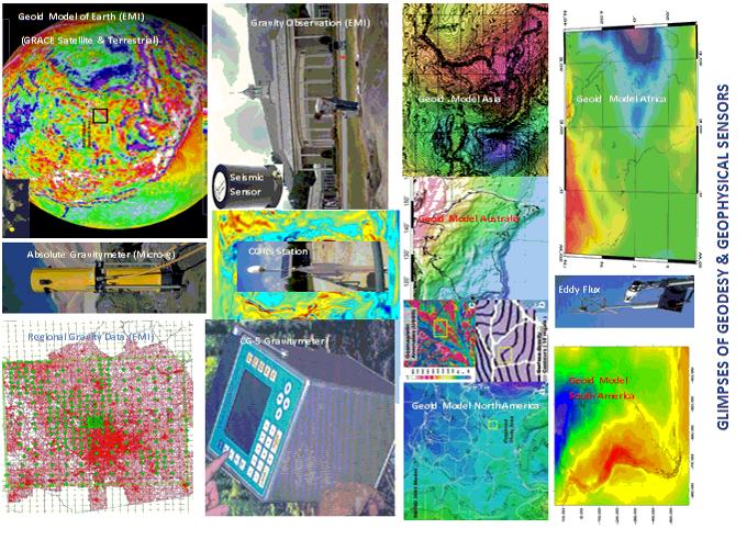
- Research was performed on computation of regional and local geoid undulations towards
height modernization using satellite and terrestrial gravity data. 61 counties in North
Georgia and 4 counties in NW South Carolina were chosen for this research. GPS and
terrestrial gravity data was collected on 300+ control points. The terrestrial gravity data
was integrated with the Gravity Recovery and Climate Experiment (GRACE) Satellite gravity
data for computation of geoid undulation. This project was funded by NASA.
- Research was performed on geoid modeling. This paper was published in GPS Navigation
Journal.
- Research was performed on GPS planning. This paper was published in the ACSM Journal of
Surveying and LIS.
- Research and planning of a continental GPS geodetic network was designed for Africa, a
paper was published in the ISPRS Proceeding.
- A First Order Geodetic Network was designed for Yemen; the project was funded by the UNDP
Yemen.
- A First Order Geodetic Network was designed for Nepal; the project was funded by the
Government of Nepal.
- High Accuracy Reference Network utilizing GPS was designed for Georgia (GA-HARN), this
project was funded by University of Georgia and supported by Surveying and Mapping Society
of Georgia, and the National Geodetic Survey.
|
|
| |
|
|