|
|
|
|
Geomatics services include:
- Digital Photogrammetry
- GPS Surveys
- GIS
- Remote Sensing
- LiDAR
The use of data for broad public purposes has become a way of life for most of North America and
Western Europe. Demographics of a national census can be verified for accuracy by comparison
with known housing stock identifiable from aerial imagery. The transportation and utility
systems in areas of known volcanic, earthquake, typhoon or hurricane vulnerability can be
modeled to predict deficiencies in capacity during catastrophic events. Property ownership
information can be integrated with historic utility billing, utility system as-builts and
aerially obtained topography to identify areas of low water pressure and model optional
solutions. Alternative investment patterns can be used to predict the impact on valuable
croplands.
These analysis, planning and basic design tools have enriched the quality of life for only those
fortunate few who live in areas which have the means to secure and utilize such tools. The rest
of the world watches and waits. EMI's primary reason for being in business is to harness the
technology of geomatics for improving quality of life.
Digital Photogrammetry
Overview
The historical advancement of society can be directly correlated with the quality and
accessibility of maps available to the general public for everyday applications. Mobility,
commerce, the free exchange of ideas, leisure travel, investment, mitigation of hazards, natural
resource exploration, record keeping, and social interaction are all facilitated. As maps became
more detailed, widely distributed and understood, quality of life improved. Balance of power and
quality of life disparities between countries were roughly a function of population size and
literacy.
In more recent times the economic disparity between developed and undeveloped countries has
widened to the point that many consider it dangerous and potentially detrimental to the
long-term good of society as we know it.
The field of photogrammetry is a rapidly changing one with new technologies and protocols being
developed constantly. In a relatively short period of time the practice of photogrammetry has
gone from the analog world to digital. For over fifty years conventional practice has been to
fly aerial photography, manually process the negatives, diapositives, contacts and prints, and
laboriously view stereoscopic pairs to capture features and topography. Within the last ten
years advances in computer technology, digital cameras, and ever-more high resolution remote
sensing satellite images have allowed firms like EMI to develop geomatics technology for optimal
utilization by different disciplines.
Unfortunately, the advances and specific applications realized in some of the western world are
limited to a comparatively small percentage of the world's population. As an Asian-American
owned, US-based firm, one of the chief aims of EMI is to share this technology with the rest of
the United States, as well as with the broader international community.
The use of laser scanning allows for conventional aerial photography to be converted to digital
format, which is then mathematically adjusted to yield high accuracy rectified images. Until
now, this technology has been limited to very few organizations and applications. The vast
majority of potential users and beneficiaries is either unaware or cannot use the technology
because of high initial set-up and training costs. If used properly, these digital mapping
techniques can result in lower costs and more practical products than conventional techniques
provide. Color infrared (CIR) images have only been used for a limited number of research
projects, but can now be used for many applications, including GIS basemapping.
The biggest hinderances to worldwide implementation of these technologies is a general lack of
awareness of their availability and broad applicability; difficulty in transfer of this highly
technical knowledge and training of others in the use appropriate methodologies and techniques;
and resistance by champions of conventional processes, who have a vested interest in limiting
process change. EMI exists to overcome each of these barriers, believing quality of life for all
of society can continue to improve by use of high quality, efficiently produced, readily
accessible mapping products for everyday applications.
GPS
Overview
The larger political jurisdictions of the world's most affluent countries, including many US
counties and cities, have available to them high quality and cost-effective digital mapping
products based on ever-improving satellite and computer technologies. However, technology
transfer to the majority of the world's countries has been slow, leaving the vast majority of
the world dependent on sub-standard and costly conventional surveying techniques. This is
particularly true with Global Positioning System (GPS) technology transfer to most of Africa,
Asia, South America and Eastern Europe. These areas are effectively left without the means to
enjoy most of the benefits of GPS technology.
GPS work involves the reconnaissance, monumentation, observation and adjustment of dispersed
points in order to calculate intervening locations and elevations of an object on the surface of
the earth. This information can then be combined with features captured from aerial or by remote
sensing satellite images to produce necessary scale accurate digital maps or Geographic
Information System (GIS) basemaps.
GPS technology can now be used to provide millimeter level positional accuracy. However, the
system requires control points of higher accuracy to achieve desired application accuracy. In
North America and some European countries a High Accuracy Reference Network of known high order
points has been established. These known points allow the collection of intermediate
project-specific points to be both accurate and affordable. For a variety of reasons, investment
in this type of network has been slow to come to most of the rest of the world. Thus, large
populations of potential beneficiaries are unable to take advantage of accurate and affordable
end-user GPS applications.
Selection and field location of the appropriate number of Global Positioning System (GPS) ground
control points is critical to the successful development and implementation of user-specific
applications. These ground control points form the backbone of subsequent mapping, engineering
or Geographic Information System (GIS) projects and control the accuracy, geometry,
authenticity, and, ultimately, determine the success or failure of these endeavors.
Only through academic research and applied practice does one gain the necessary expertise to
optimize GPS applications, whether on a country-wide or project-specific basis. EMI has this
experience.
Geographic Infromation Systems (GIS)
Overview
The use of data for broad public purposes has become a way of life for most of North America and
Western Europe. Demographics of a national census can be verified for accuracy by comparison
with known housing stock identifiable from aerial imagery. The transportation and utility
systems in areas of known volcanic, earthquake, typhoon or hurricane vulnerability can be
modeled to predict deficiencies in capacity during catastrophic events. Property ownership
information can be integrated with historic utility billing, utility system as-builts and
aerially obtained topography to identify areas of low water pressure and model optional
solutions. Alternative investment patterns can be used to predict the impact on valuable
croplands.
These analysis, planning and basic design tools have enriched the quality of life for only those
fortunate few who live in areas which have the means to secure and utilize such tools. The rest
of the world watches and waits. EMI's primary reason for being in business is to harness the
technology of geomatics for improving quality of life.
Remote Sensing
Overview
Remote sensing is the science and art of deriving information about an object from measurements
made at a distance, i.e., without actually coming in contact with it. Remote sensing data is
captured using different platforms (airborne, satellite) and sensors (camera, MSS, CCD, etc.).
Remote sensing data can include the entire spectrum of electromagnetic radiation (visible,
infrared, thermal, microwave, radiowave, etc.) as compared to the photogrammetry, which uses
only visible portion of the electromagnetic spectrum. In a vague term remote sensing can be
recognized as a system that uses satellite platforms. The first remote sensing system was the
Landsat program (Landsat 1-2-3-4-5-6-7). Currently, we are on the seventh generation of the
Landsat program collecting terrestrial image data. There are many other government remote
sensing programs including SPOT and IRS.
In the nineties, private satellite corporations started collecting high-resolution remote
sensing data using polar orbiting satellites. Currently, Space Imaging's IKONOS satellites, and
Orbimage's Orbview satellites acquire 1-meter (PAN) and 4.0 meter (MS) satellite images. There
are a few governmental high-resolution remote sensing programs including the French SPOT and the
Indian Remote Sensing (IRS) satellites, which collect data up to 2.5m resolution.
EMI's technical team believes that high-resolution satellite imagery will replace medium and
small-scale mapping (e.g. USGS Quad Maps, DOQQs). To tap into this vast market, EMI is teaming
up with the Satellite Corporation GeoEye, which will increase EMI's mapping capabilities for any
size and scale throughout the world. EMI's team has been involved in processing and analysis of
different types of the above-mentioned satellite data for various applications.
LiDAR
Light Detection and Ranging (LiDAR)
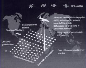
Light Detection and Ranging (LiDAR) consists of the following components: scanner, Airborne GPS,
Inertial Measurement Unit, ground based GPS stations, known control points, computer to store
the data and software to process the data. The biggest challenge with the LiDAR system would be
to correlate the data from different sources to the same time stamp ( a difference of 1-nano
second will cause 30 cm error in the data, speed of light ~300000000 meter/109 ).
Data processing and quality control procedures for all primary data collection are very
stringent at EMI, since without the primary data no project can proceed further. However, to get
the best possible quality data, personnel at EMI spend ample time in project planning and
research. EMI provides strict guide lines to its sub-consultants and work closely with them
until the data capture is completed successfully.
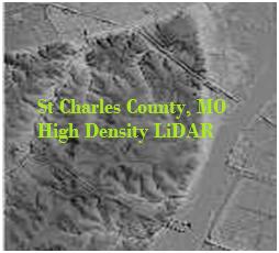
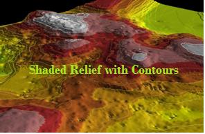
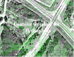
Collection of topographic data has been a very cumbersome and expensive part of mapping. With
the advent of digital photogrammetry and LiDAR technology, topographic mapping at 1.0 FT contour
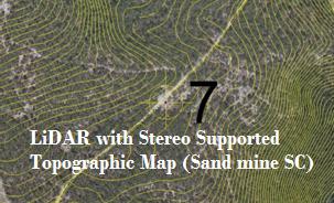
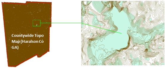
intervals can be achieved within a fraction of cost and time. [Topographic data for engineering
design and emergency forecasting, hydrologic modeling, storm water modeling are very critical in
terms of its accuracy. Earth Mapping International has been using digital photogrammetry in
conjunction with LiDAR data to produce 2.0' contour topographic mapping for engineering
projects. Some samples of our work is shown on the reverse side]
The topographic data types and formats EMI provides are: 0.5-Foot Contour Mapping for GDOT,
2-Foot Contour Mapping for various engineering projects, 4-Foot Contour mapping for countywide
mapping projects.
The data formats: 3_D AutoCAD dwg file, CaiCE 3_D file, Microstation dgn file, ASCII DTM file,
ESRI shape file. EMI can provide the DEM/DTM data in any format as per the client request.
|
| |
|
|